concept & vision
we highlight the extensive existing cable car network and focus on its axes, extended with the intention to reconnect the higher informal city of the cerros (hilltops) to the lower formal/institutional city and the water. We extend each line to outline different proposed activity zones that develop out from the funicular axis to engage the larger urban territory.
Our project operates at several different levels: urban planning and zoning, architecture, industrial design, graphics, and mapping. These different modes are interconnected and developed as such, moving continuously through different scales and linking approaches and strategies in a conceptually energetic manner
design & architecture
our proposal reflects these different levels, from consolidating the urban re-planning of the existing funiculars throughout the city, to the midscale proposed reactivation of the Espiritu Santo axis as a sort of infrastructural 3D zoning, to the intervention on the cubicle of the cable car itself, to the production of the Ascensores Valparaiso’s map—not unlike the subway/underground map of a large metropolis.
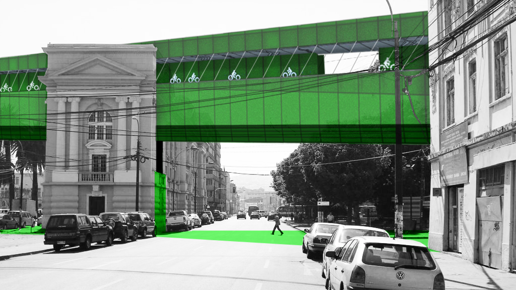
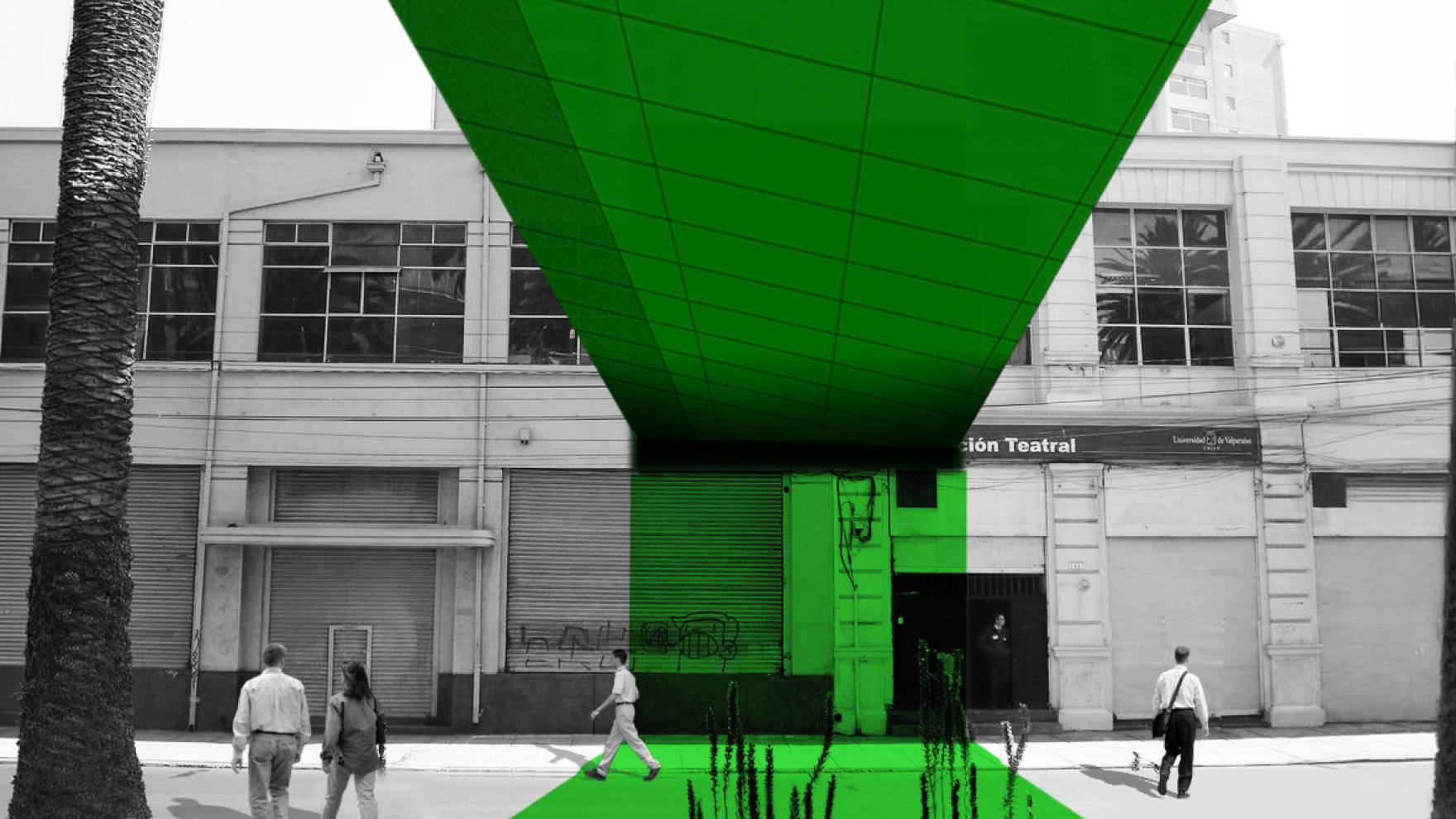
We select the green axis of Espiritu Santo to test the interaction with existing public spaces and buildings, such as Plaza Victoria, Santiago Library and La Sebastiana Museum, and extrude it linearly as a mark or a volume that crosses the city, its open spaces and its built fabric, adjusting to different conditions. Retail and culture fill the volume between pedestrian and bike paths, while the intersection with existing buildings becomes new public space and vertical circulation links
program & use
the ascensor itself is a switch point along the color field. As both the generator and the glitch within the inhabitable map, the two up-and-down cabins are a single box split in two, with the split faces as the only glazed façades on an otherwise mute box. Refocusing the experience of the ride from mere panorama toward the encounter with the car’s opposite half – which happens only once at the mid-point - the ascensor’s journey is centered on the people’s face-to-face interaction and expectation as we go up or down experiencing this ingenious early engineering industrial infrastructure. The two terminal ends of the Espiritu Santo green band are look-out and access points to the city, with views toward areas of urban expansion and the adjacent cerros on the hills, and connection with the waterfront – currently severed by the left-over fabric of the industrial port – and the openness of the Pacific Ocean at the bottom
impact & significance
our proposal frames a larger ambition of reimagining the city of Valparaiso, which until the 1914 opening of the Panama Canal was the most important port on the South Pacific coast.
The new infrastructure responds to the current post-earthquake status with a significant revitalization plan that, starting from the very particular existing network of funiculars, aims at a larger urban regeneration through the injection of new activities, new energy, storm-water management, and an integrated circulation to connect top and bottom favoring public space and offering a new pedestrian experience.
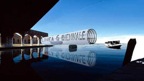
The installation at the Biennial offers the experience of the Ascensor Espiritu Santo through technology, an early low-tech attempt to be in the digital space proactively